
In this guide, you’ll learn:
- The Surging Popularity Of Agricultural Drone Mapping
- How Drone Surveying & Mapping Transforms Your Land Management
- 5 Drone Mapping Applications Every Farmer Should Be Using
- A Step-By-Step Guide To Starting Drone Mapping On Your Farm
The Surging Popularity Of Agricultural Drone Mapping
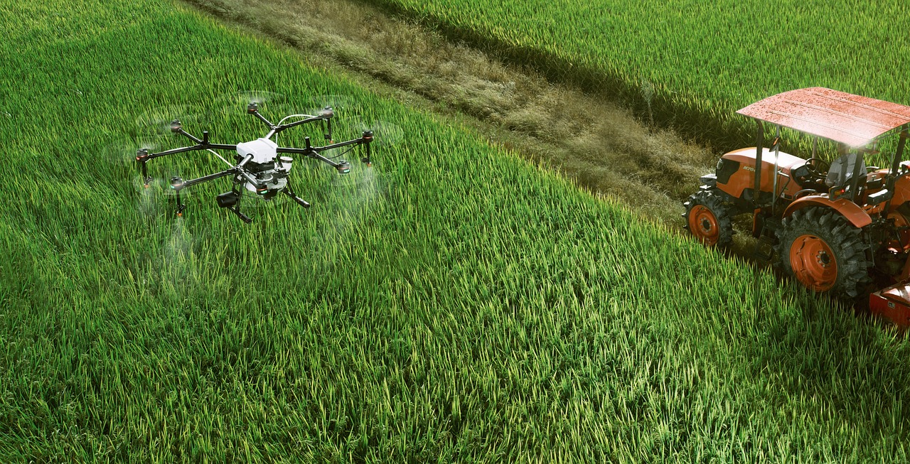
The stats are clear: The agriculture drone market revenue reached $2.74 billion in 2024 and is expected to skyrocket to over $10 billion by 2030, which is an annual growth rate of 25%. But what’s driving farmer adoption of drone technology? Drone mapping allows you to see a virtual bird’s eye view of your entire operation. Instead of having to guess or take samples to understand what’s happening across hundreds or thousands of acres, you have precise, real-time data for every part of your farm. Here’s a simple example of how drones make a difference – scouting your fields by foot only allows you to access a tiny portion of your land every day. Drones give you an aerial perspective that can cover your entire operation in hours, not weeks or months. The technology for drones for surveying and mapping in agriculture is also improving fast. Modern drones are being built with multispectral sensors, thermal imaging capabilities, and GPS precision that achieves centimeter-level accuracy. The key point here is… It’s not just about taking aerial photos. The information you gather from your drone surveys can lead to better decisions, lower costs, and increased yields on your farm.How Drone Surveying & Mapping Transforms Your Land Management
Traditional farming operations have been forced to guess a lot about the state of their land, but drone mapping is changing that. The biggest benefits are…Monitoring Fields In Real-Time
Say goodbye to taking inventory of your fields by walking row by row. Drones with sophisticated sensors can reveal problems well in advance of when they would be visible by the naked eye. Multispectral imaging will show plant stress, nutrient deficiencies, irrigation issues, and other problems long before you could see them on the ground. This early warning system allows you to treat the issue before it becomes much more expensive to manage.Precision Application Mapping
Knowing where and when to apply your fertilizers, pesticides, herbicides, and other inputs is crucial. Drone mapping creates precise application maps that show exactly which areas of your land need treatment. The more you can target specific problem areas, the more you save on inputs, and the lower your impact on the environment by reducing chemical runoff.Soil Health Analysis
Different areas of your fields may have different soil composition and characteristics, and understanding these zones is key to producing optimal yields. Drone mapping can help you see where the soil varies so you can create a unique management plan for every area of your farm.5 Drone Mapping Applications Every Farmer Should Be Using
Let’s dive into the most exciting ways farmers are using drone mapping right now:Field Mapping & Boundary Surveys
Knowing your field boundaries is critical for planning planting, spraying, harvest, and more. Drone surveys give you precise dimensions so you can take full advantage of all your productive acreage. You can also spot areas where drainage may need to be improved or where erosion control is an issue.Crop Health Analysis
This is where it gets even more interesting… Crop stress can be visible long before symptoms appear with the right drone sensors. Catching disease early can often mean the difference between a remediable situation and total crop failure. Crop growth can be monitored throughout the growing season as well, so you get data-driven guidance on optimal harvest timing.Irrigation Mapping
Efficient water management is more important than ever as water availability becomes a limiting factor in more regions. Drone surveys can show you where you’re over-irrigating or under-irrigating and help you optimize your water usage.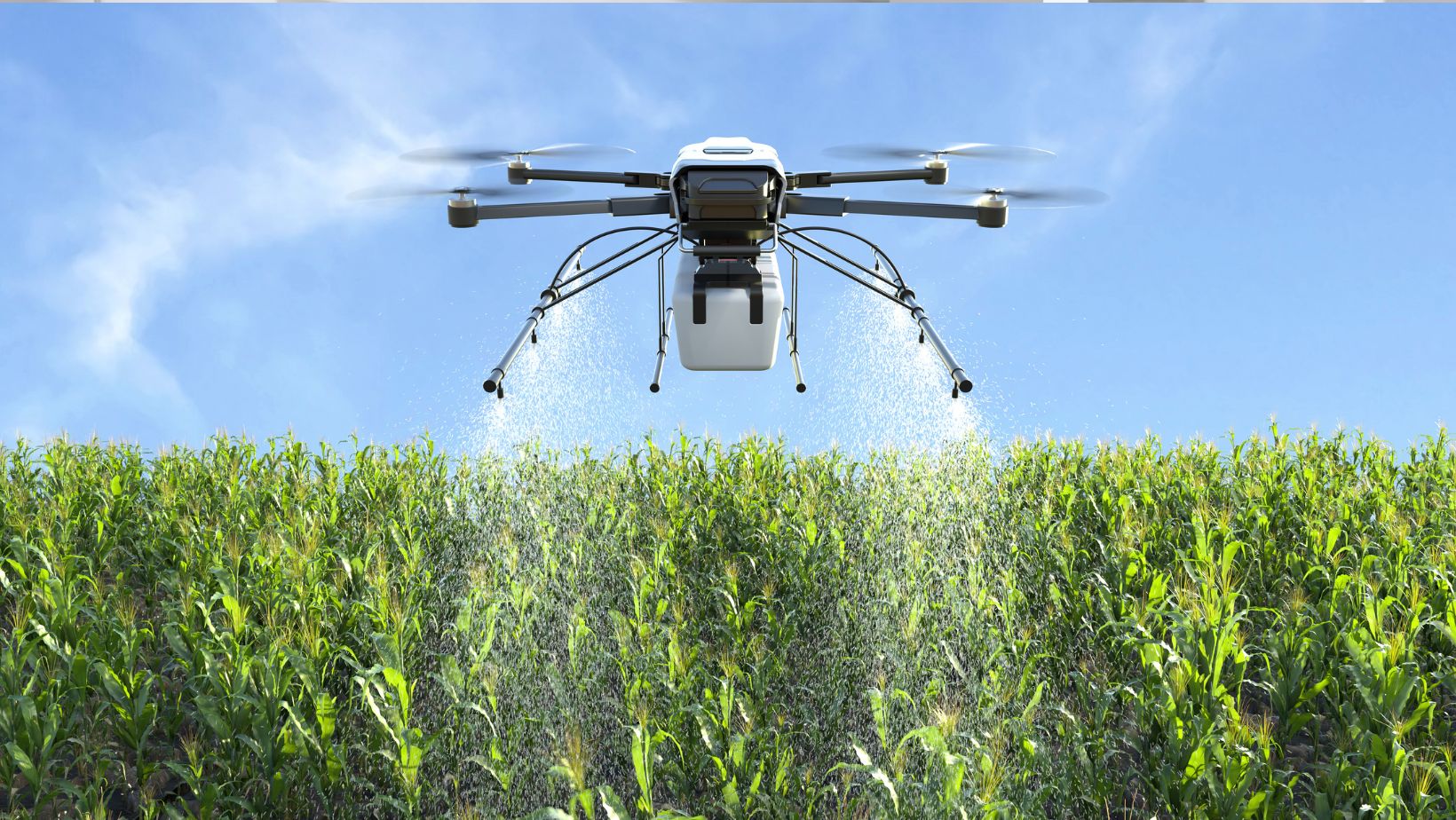 Thermal imaging can even detect leaks in buried irrigation lines before they cause major issues.
Yield Prediction & Planning
Crop development patterns throughout the growing season can be used to predict yields with surprising accuracy. This data is extremely valuable for planning harvest logistics, storage, and marketing.A Step-By-Step Guide To Starting Drone Mapping On Your Farm
So how do you implement drone mapping on your farm?Select The Right Drone Equipment
Your first step is to choose your drone platform. You don’t have to go out and buy the most expensive drone right away, but you do need the right capabilities. Key things to look for in a drone for agriculture include:- GPS precision capabilities
- Multispectral sensors and/or interchangeable sensor payloads
- Flight time to cover the areas you need
- Weather-resistant or water-proof models
Plan Your Survey Strategy
Before you fly, plan out your survey strategy. Which fields or areas will you be monitoring, and how often will those surveys occur? A good strategy will consider:- Field size and layout
- Crop types and their growth stages
- Existing problem areas for close monitoring
- Seasonal timing for best data value